California’s Yosemite National Park welcomes millions of visitors each year—drawn to its dramatic waterfalls, giant sequoias, abundant wildlife, and awe-inspiring cliffs, like Half Dome and El Capitan.
Whether you’re looking for the adventure vacation of a lifetime, want to immerse yourself in the stillness of nature—or simply hike, backpack or ski in one of the most beautiful places on earth, you’ll find your place in Yosemite.

Yosemite National Park – Buy this Poster
History
The moment you arrive at Yosemite, you’ll begin to experience what others have cherished for more than 10,000 years—when American Indians first put down roots in Yosemite Valley.
Surrounded by natural beauty, seemingly endless wilderness, sheer cliffs and remarkable tranquility, a spirit of discovery will well up inside you.
You’ll be following in the footsteps of the West’s first non-native settlers, who came for the California gold rush in 1850 and returned home—some with riches and some with stories of a place so grand in scale and so breathtaking in beauty that words alone couldn’t do it justice.
As the stories spread, the first tourists took to horseback discovering the farthest reaches of the Yosemite Valley. Its sufficient wildlife—deer, bear, and fish—meant a reasonable supply of food, and with that came the area’s first year-round settlers by the mid-1860s.
Remarkably, some of the early settlers had the foresight to realize Yosemite’s extraordinary beauty and rich natural resources needed to be preserved—and assisted in protecting the Giant Sequoias from logging.
While the nation was bitterly divided by the Civil War, President Abraham Lincoln signed a grant that permanently protected the land. Yosemite was one of the first territories preserved for its scenic beauty, public use, and continued enjoyment – and Yosemite was part of the foundation for what became America’s National Parks.
In 1890, Yosemite was established as a National Park. And in 1916, the newly formed National Park service took the reigns in managing Yosemite National Park.
Today, about 4 million people visit Yosemite each year—hikers, climbers, campers, bikers, photographers and nature lovers of all kinds—charmed by the park’s awe-inspiring beauty and eager to experience one of America’s greatest natural splendors.
Getting There
With a little planning, it’s easy to get to Yosemite National Park from anywhere in the world. Travelers that fly to California can rent a car in San Francisco (4 hours away) or Sacramento (3 hours away). The public roads are maintained year-round—except for the eastern entrance on Tioga Road (Highway 120 through the park). Tire chains may be required from October to April.
Yosemite Area Regional Transportation System (YARTS) provides bus service to Yosemite. For information, call 877.989.2787.
Greyhound doesn’t offer direct bus service to Yosemite, but can be combined with YARTS service from Merced, CA. 800.229.9424 or 800.531.5332 (en Español)
Visitors can use the Tuolumne Meadows Hikers bus to reach Tuolumne Meadows on select days during the summer season.
AMTRAK® Trains serve San Diego, Los Angeles, Fresno, San Jose, San Francisco and Sacramento to and from Merced/Riverbank and connect with YARTS bus lines for direct buses into Yosemite Valley. For information call 800.872.7245 or visit http://www.amtrak.com/
Cars are welcomed in Yosemite National Park, and visitors pay an entrance fee of $30 in summer and $25 in winter. There is free parking in Yosemite but it is limited. So arrive early if you want one of these parking spots. Once you’re at the Park, we recommend that you take the efficient shuttle bus system that’ll get you everywhere you need to go.
Plants & Wildlife
Yosemite National Park plays host to a myriad of plants and wildlife through a range of ecosystems that span 1,169 square miles.
he native plants of Yosemite National Park are a significant part of the exquisite beauty and biological diversity of the park. The combination of climate, topography, moisture, and soils influence the distribution of plant communities across an elevation gradient from 1,800 feet (549 m) to over 13,000 feet (3,900 m).
Vegetation zones range from scrub and chaparral communities at lower elevations, to subalpine forests and alpine meadows at the higher elevations. There are 800 miles of trails in Yosemite, which provide access for exploring the different vegetation zones.
Foothill-Woodland Zone
The lowest elevations in Yosemite are found on the western boundary of the park at the El Portal Administrative Site, which is at approximately 1,800 feet (549 m). This is the foothill-woodland zone, an area that is hot and dry in the summer with very little or no snow in the winter. Plants within this zone include chamise, ceanothus, manzanita, blue oak, interior live oak, and gray pine. These plant communities can also be found near Hetch Hetchy reservoir.
Lower Montane Forest
Beginning near the 3,000 foot (900 m) elevation, the hot, dry summers and cool, moist winters of the Mediterranean climate give rise to the lower montane forest zone. The accumulation of several feet of snow during the winter is not uncommon and can stay on the ground for several months.
The diversity of tree species found in this zone make this a beautiful and interesting forest to explore. The lower montane forests are found along the western boundary of the park and include trees such as California black oak, ponderosa pine, incense-cedar, and white fir.
Yosemite’s giant sequoia groves including the Mariposa, Merced, and the Tuolumne Groves are also found within this vegetation zone. The lower montane forest encompasses 166,000 acres (87,200 ha) and can be seen in Yosemite Valley and along the Wawona, Hetch Hetchy, and Big Oak Flat Roads.
Upper Montane Forest
The upper montane forest begins at higher elevations near 6,000 feet (1800 m), where the montane climate is characterized by short, moist, cool summers and cold, wet winters. Snow begins to fall in November and may accumulate to depths up to six feet and remain until June.
Pure stands of red fir and lodgepole pine are typical of this forest. Jeffrey pine, which has bark that smells like vanilla, and the picturesque western juniper can also be found in this zone. Beautiful wildflowers bloom in meadows from June through August.
Upper montane forests encompass 216,000 acres (87,000 ha) and may be viewed from the Tioga Road east of Crane Flat and in areas north and south of Yosemite Valley, such as along the Glacier Point Road.
Subalpine Forest
The upper montane forest is replaced by the subalpine forest near 8,000 feet (2450 m), where the climate is cooler with an even shorter growing season due to long, cold, and snowy winters. Accumulations of three to nine feet of snow are typical.
The western white pine, mountain hemlock, and lodgepole pine are found in this forest with many subalpine meadows that flower from July through August. This zone can be seen from the Tuolumne Meadows area east to Tioga Pass and encompasses 297,000 acres (120,000 ha).
Alpine Zone
The alpine zone of Yosemite begins near the 9,500 foot (2,900 m) elevation and is easily distinguished as it is above tree line. No trees grow in this zone due to the harsh climatic conditions. Short, cool summers with long, cold, and snowy winters are typical at these elevations.
Many exposed granitic outcroppings, talus slopes, and boulder fields limit the amount of vegetation that grows here. The herbaceous plants need to flower and produce their seeds quickly during the short, frost-free period of summer.
This zone covers 54,362 acres (22,000 ha) in Yosemite and is only viewed up close by hiking or climbing into the high elevations of Yosemite’s wilderness.
Alpine Zone
The alpine zone of Yosemite begins near the 9,500 foot (2,900 m) elevation and is easily distinguished as it is above tree line. No trees grow in this zone due to the harsh climatic conditions. Short, cool summers with long, cold, and snowy winters are typical at these elevations. Many exposed granitic outcroppings, talus slopes, and boulder fields limit the amount of vegetation that grows here. The herbaceous plants need to flower and produce their seeds quickly during the short, frost-free period of summer. This zone covers 54,362 acres (22,000 ha) in Yosemite and is only viewed up close by hiking or climbing into the high elevations of Yosemite’s wilderness.
Animals
Yosemite National Park has approximately 90 mammal species, as well as birds, fish,
amphibians, reptiles and insects.
Seventeen mammals have a special status by either the federal or California state governments due to declining population numbers or to a lack of information about their numbers and distribution.
Ongoing research has put a magnifying lens on several mammal species within the park and continues to build on work in the 1920s by famous mammal researcher Joseph Grinnell.
The most common wildlife includes black bears, Sierra Nevada big horn sheep, Sierra Nevada red fox, pacific fisher, mountain lions, deer, bats, and rodents.
An astounding 262 species of birds have been documented in Yosemite, including 165 resident and migratory species. Great gray owl research shows the Sierra Nevada is home to a genetically distinct population, compared to great gray owls outside of California.

Winter in Yosemite National Park – Buy this Print
Fishing
Yosemite National Park offers some of the most exciting and scenic fishing in the world—with an abundance of rainbow and brown trout keepers. Seven-hundred-and-seventy miles of permanent streams combine with Yosemite’s pristine mountain lakes to set the scene for world-class fishing.
All lakes and reservoirs are open to fishing year-round. The fishing season for Yosemite’s rivers and streams begins on the last Saturday in April and continues through November 15th.
All persons 16 years of age and older must have a valid California sport fishing license for fishing in Yosemite National Park, which can be purchased online through the California Department of Fish and Wildlife.
Fishing licenses are also available at the Mountain Shop in Yosemite’s Half Dome Village.
From the first recorded planting in 1877 until 1990, more than 33 million fish were stocked into waters of Yosemite. Today, the native and non-native species include:
Native Species:
- Rainbow Trout (Lower Elevations)
- California Roach
- Sacramento Pikeminnow
- Hardhead
- Sacramento Sucker
- Riffle Sculpin
Non-Native Species:
- Rainbow Trout (Higher Elevations)
- Bullgill
- Smallmouth Bass
- Brook Trout
- Brown Trout
- Lahontan Cutthroat Trout
- Golden Trout
- Rainbow Trout
- Rainbow-Golden Hybrid Trout
- Rainbow-Lahontan Cutthroat Hybrid Trout
Things to Do

Mountains Reflecting In Merced River In Winter, Yosemite National Park, California – Buy This Print
Yosemite National Park is the ultimate outdoor playground—year round. Warm months are typically filled with sunny days that welcome legendary hikes and breathtaking views. Wintertime blankets Yosemite in snow, creating the perfect landscape for skiing, skating and snowshoeing. Every season has its not-to-be missed highlights—which is why so many visitors come back time and time again.
Explore the Valley
Yosemite Valley is ripe with beauty! Check out these ways to get around and take in the sights and sounds.
- Biking
- Rafting
- Guided Bus & Tram Tours
- Discovery Programs
- Food & Wine Events
Experience Adventure
Looking for a few thrills during your Yosemite visit? You’re sure to find something to get your blood pumping with these activities.
Yosemite Mountaineering School & Guide Service got its start in 1969, and was an instant hit with park visitors. Today, the rock climbing guides can get you to the highest peaks in Yosemite National Park. As the only authorized climbing guides in the Park, they know these cliffs like no one else — and can share their unparalleled knowledge with everyone from pros to complete novices. To help ensure your safety on the mountain, every guide is a certified Wilderness First Responder or has a Wilderness EMT certification.
Each day the climbing school offers climbing lessons beginning at 8:30 am. Additional programs include private guided climbs throughout the day and climbing and camping equipment rentals — with all the gear you need to make it to the top and then settle in for an evening at your campsite.
Beyond rock climbing lessons, the school also offers group hikes, guided overnight backpacking trips and, during the winter, cross-country ski lessons — as well as overnight Glacier Point Ski Hut trips.
- Guided Hikes
- Backpacking Trips
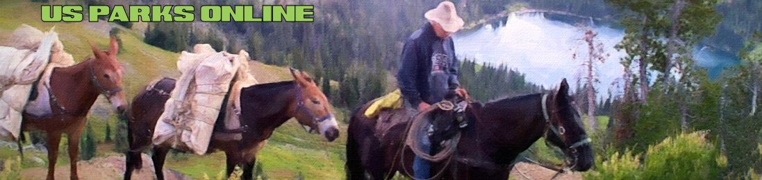
- Trail Rides
- High Sierra Camp Trips
Discover Winter
More snow can be even more fun! Find out the best way to enjoy your time in the snow.
- Skiing & Snowboarding
- Ice Skating
- Cross-Country Skiing
- Snowshoeing
- Snow Tubing
Rock Formations & Cliffs
Millions of visitors come to California’s Yosemite National Park each year to see—and even climb—the Yosemite Valley’s awe-inspiring rock formations. Towering sheer cliffs striped with ribbons of flowing waterfalls rise from the valley’s floor, creating dazzling photo opportunities and thrilling nature lovers. In the summer months (or with an overnight ski trip in winter), visitors can view it all from high above, at Glacier Point.
Cathedral Rocks – While El Capitan is better known, Cathedral Rocks and Spires is considered by many to be the most beautiful rock formations in Yosemite National Park. Their unusually symmetrical balance—appearing to be a massive, triple-rock formation—is a testament to nature’s power. Towering 2,000 feet skyward, it’s a view not to be missed.
Because of their grandeur and their height (2,000 ft tall), they’re visible year-round. There is no hiking trail to the base of Cathedral Rocks but the rock formations are visible from Yosemite Valley.
Opposite El Capitan, Cathedral Rocks & Spires can be seen from turnouts along Southside Drive, Tunnel View (pictured), and El Capitan Meadow.
El Capitan – Soaring over 3,590 feet skyward, El Capitan is a bucket list destination for elite rock climbers from around the globe. Those who are less brave can be awed at watching the climbers slowly and carefully ascend El Capitan.
El Capitan is always visible from Yosemite Valley—and the view is always changing with the light and with the seasons.
El Capitan is opposite Bridalveil Fall and is best seen from the roads in western Yosemite Valley, including Tunnel View, Bridalveil Fall area, and El Capitan Meadow.
Glacier Point is one of the most awe-inspiring of all Yosemite views. Perched on an outcropping of granite 3,000 feet up on the rim of the Yosemite Valley, you’ll fill your eyes with one of the greatest sights on earth—mountain peaks, waterfalls and the pristine valley below. Best of all, visitors of all ages can make it to the top via a well-traveled road in the spring and summer.
Glacier Point is best reached from Yosemite Valley via Glacier Point Road, which is open from approximately late May or early June through October or November. In winter, Glacier Point Road closes and the only way up to Glacier Point is by skis or snowshoes—a far more challenging way to summit, but undeniably rewarding.
Glacier Point Road provides easy access to Glacier Point, thus making the base of the rock a popular spot, attracting hundreds of visitors a day. While you won’t get the feeling of “escaping it all” it’s an excellent first stop at Yosemite, and is bound to get everyone’s heart racing with the anticipation of discovery and more beauty to come.
Half Dome, measuring 8,842 ft above sea-level, is one of the most iconic cliffs in Yosemite, known for its sheer magnitude—a smooth granite wall rising nearly a mile above the valley. In the mid 1860s, it was deemed “inaccessible” and thought to be impossible to climb. But a decade later, mountaineer George Anderson had summited the peak. Since then, hundreds of thousands of people—all fit and experienced—have reached the summit with a strenuous, challenging hike. Others reach the peak after an exhaustive climb up the cliff’s sheer face.
Because Half Dome is a massive slab of granite rising nearly a mile from the Valley floor, it’s visible from many points in Yosemite, all year long. If you’re thinking about hiking to the top (strong, experienced hikers can make the round-trip in 10-12 hours), it’s best to do it when the climbing cables are in place—which is late May through early October. Permit required. Trailhead to Half Dome is at shuttle stop 17.
Because of its sheer height, Half Dome is visible nearly anywhere in eastern Yosemite Valley. Any drive along the road between Yosemite Village and Yosemite Valley Lodge and roads near Half Dome Village will afford you a terrific view of Half Dome.
Mirror Lake (which, despite its name isn’t really a lake) is an ideal place to get close and take in great views of Half Dome. It’s a two-mile round-trip walk on a paved trail with a 6.6% to 10.6% grade.
Accessibility: Cars displaying an accessibility placard can drive to near Mirror Lake.
Mt. Dana is on the eastern edge of Yosemite, with its peak reaching over 13,060 feet. It is the second-highest mountain peak in the Park.
Best time to see Mt. Dana is when Tioga Road is open, which are typically late May/early June through late October/early November.
Best view of Mt. Dana is from Tioga Road, west of Tioga Pass.
Mt. Gibbs (12,764 ft tall) is adjacent to Mt. Dana. Best time to see Mt. Gibbs is when Tioga Road is open, which are typically late May/early June through late October/early November. Best view of Mt. Gibbs is from Tioga Road, west of Tioga Pass.
Mt. Lyell – Located on the southeast boundary of Yosemite National Park, Mt. Lyell is the tallest peak in the Park (and all of Tuolumne County) at over at 13,100 feet. Mt. Lyell also holds the largest glacier/ice field in the park: the Lyell Glacier. Unfortunately, Lyell Glacier is no longer active due to a warming climate.
Best time to see Mt. Lyell is when Tioga Road is open, which is typically late May/early June through late October/early November, so this is the only time you’ll be able to have access to Mt. Lyell.
Best view of Mt. Lyell is from a distance – thus we recommend viewing Mt. Lyell from Glacier Point. To get to Mt. Lyell, park at the southeast end of the Cathedral Range. You can get there by traveling on Tioga Road, turning towards Tuolumne Lodge and parking just before the Lodge in the parking lot on the left side of the road.
Sentinel Rock – Opposite Yosemite Falls, you’ll find Sentinel Rock—watching over the Park like a guard in a tower. It’s a stunning monolith of granite, is one of the most famous rock formations in Yosemite and a favorite of photographers and painters. In the spring, Sentinel Falls pours down next to Sentinel Rock.
At 7,038 ft tall, Sentinel Rock is visible all year—though the view changes dramatically with the seasons and with the passing daylight.
One of the best views of Sentinel Rock is from Yosemite Valley Lodge. The turnout at Tunnel View also offers views, and is reached by entering the park via Wawona Road. Hikers can get great views from Yosemite Falls Trail.
Hikers wanting to climb Sentinel Dome, near Sentinel Rock, can take a ranger-led hike from Glacier Point for a really spectacular view. The hike begins from the Sentinel Dome trailhead on the Glacier Point Road.
Three Brothers – Just east of El Capitan, you’ll find the Three Brothers: Eagle Peak (the highest “brother”), Middle Brother, and Lower Brother. Naturalist John Muir wrote considerably about the Three Brothers, and felt their view was the most spectacular in all of Yosemite. This is not one to be missed.
If your goal is to take in the stunning views, you’ll be happy to discover Three Brothers (7,783 ft tall) is visible year-round.
The Cathedral Beach Picnic Area offers some of the best views of the Tree Brothers. Cathedral Beach Picnic Area is on the left side of the road as you drive east on Southside Drive into Yosemite Valley.
Waterfalls

Bridal Veil Falls, Yosemite National Park – Buy this print
Yosemite National Park is home to thousands of waterfalls—from towering spectacles with a half-mile of cascading water, to tiny streams of white that drop only a few feet. Spring is the best time to experience Yosemite’s waterfalls, when the winter’s massive snowfall melts away and heads toward the Pacific Ocean.
Plan your waterfall excursions for May and June, when they’re at their most impressive. By the end of summer, many are only a trickle or have completely dried up.
WARNING: Never enter the water at the top of a waterfall! Even shallow areas have currents strong enough to sweep you over the falls.
Bridalveil Fall – When you enter Yosemite Valley Bridalveil Fall comes into full view—and it’s clear why Yosemite earliest pioneers named it Bridalveil Fall, the way it resembles a bride’s veil blowing in the breeze. Bridalveil Fall flows all year with peak flow in May.
Bridalveil Fall flows all year-round and is always beautiful to see. However, like all waterfalls in Yosemite, Bridalveil Fall does experience lower water levels in late summer/early fall.
You literally can’t miss Bridalveil Fall: The best view is from near the tunnels on the Wawona Road or Big Oak Flat Road and from a signed parking lot on your way into Yosemite Valley.
You can walk to the base on a short but very steep (up to 24% grade) trail in under five minutes. In the spring and summer, parts of the trail can be wet. In the winter, it can become icy and slippery.
Chilnualna Falls is made of five tiers up to 300 ft in height, and makes for a fascinating display—seeing the five sections flowing separately yet together.
Chilnualna Falls flows all year-round and is always beautiful to see. However, like all waterfalls in Yosemite, Chilnualna Falls does experience lower water levels in late summer/early fall.
To see Chilnualna Falls, you will need to hike the trail leading to fall. The first section of the trail is relatively easy and you will see the first tier of the fall. Strong, experienced hikers can start from the trail head at the end of Chilnualna Falls Road and climb to the top, which is steep and challenging.
Horsetail Fall – One of the most wondrous and beautiful sights at Yosemite—and one of the rarest. For just 20 days in February, if you’re lucky enough, the Horsetail Fall’s water will be flowing, and you’ll be treated to a fiery display of reds and yellow. Caused by the setting sun’s rays mingling with the falling water, the display is dazzling as the lava-looking water cascades down El Capitan.
Horsetail Fall offers a steady water flow December through April. The best display is in mid-to-late February when the sunset is reflected in the water’s mist.
Park at the El Capitan picnic area (on Northside Drive, 1.7 miles west of Yosemite Valley Lodge) or in turnouts just east of the picnic area. The waterfall is visible from the road.
Illilouette Fall – While you can’t view it from the road, Illilouette Fall is hidden from view inside Illilouette Creek Canyon below Glacier Point. But those who see it say its obscurity adds to its delight.
Illilouette Fall flows all year-round and is worth a visit. However, like all waterfalls in Yosemite, Illilouette Fall does experience lower water levels in late summer/early fall.
For the best viewing of Illilouette Fall, experienced hikers can take in the view from the Panorama Trail, which is a few miles from Glacier Point. The fall is also visible when hiking to Vernal Fall but does not provide the best vantage point. The top of Illilouette Fall is visible at Washburn Point (Glacier Point Road).
Hiking: Take the Panorama Trail from Glacier Point to Illilouette Fall (a few miles down the trail) and back to Glacier Point (strenuous). Or, from Illilouette Fall continue to Yosemite Valley (6.5 miles), but make sure you’re prepared for this roughly 6-hour strenuous hike.
Nevada Fall is a towering 594-foot high waterfall, Nevada Fall is at westernmost side of Little Yosemite Valley. Identifiable by its curved shape and dramatic mist, which makes it one of the most picturesque waterfalls in Yosemite National Park.
Nevada Fall flows all year-round and is a must see. However, like all waterfalls in Yosemite, Nevada Fall does experience lower water levels in late summer/early fall.
By Car: Viewing from Glacier Point will give you an impressive (yet far-away) view of Nevada Fall. The road to Glacier Point is generally open from late May through November, and a wheelchair-accessible trail is available when the road is open.
Hiking: Strong, experienced hikers can reach the top of Nevada Fall by continuing along the Mist Trail (from Vernal Fall). The John Muir Trail also leads to the top of Nevada Fall (bypassing Vernal Fall). Be prepared for a strenuous hike. Note that in winter, part of the Mist and John Muir Trails are closed, but both Vernal and Nevada trails are accessible. However, the trails may be very snowy/icy.
Ribbon Fall is the tallest waterfall in Yosemite National Park, and often only flows March through June. Not only is it the tallest fall in Yosemite, it’s the tallest waterfall in all of North America.
Ribbon Fall general flows March through June. So plan your trip accordingly if you’s like to see this waterfall.
The best view of Ribbon Fall is right from the road as you drive into Yosemite Valley, just beyond the turn for Bridalveil Fall (parking is available in turnouts).
Sentinel Fall – Located on the south side of Yosemite Valley, Sentinel Fall (about 2,000 ft tall) is just west of Sentinel Rock. Like Yosemite Falls, it’s comprised of multiple cascades—smaller though no less impressive.
Sentinel Fall flows March through June and is beautiful to see. Viewing of Sentinel Fall is best on Southside Drive near the Sentinel Beach Picnic Area, and also near the Four Mile Trailhead. You can also see Sentinel Fall near Leidig Meadow, which is near Yosemite Valley Lodge, and while hiking Yosemite Falls Trail.
Vernal Fall has a 317-foot plunge and is just downstream of Nevada Fall—both of which are visible from Glacier Point.
Vernal Fall flows all year-round and is beautiful to see. However, like all waterfalls in Yosemite, Vernal Fall does experience lower water levels in late summer/early fall.
Washurn Point offers the best view of Vernal Fall. For a wide, expansive view of Vernal Fall, Glacier Point is the ideal spot. The road to Glacier Point is generally open from May through October, and a wheelchair-accessible trail is available when the road is open. Strong, experienced hikers can hike to Vernal Fall on a steep, strenuous trail.
Wapama Falls – Dropping a sheer 1,000 feet, Wapama Falls is on of the most powerful waterfalls in Yosemite National Park—and one of the few that can actually stop you in your tracks, as it impossible to pass over its trail bridge when it’s flowing hardest. Despite its beauty and power, few people visit Hetch Hetchy Valley to see this majestic waterfall.
WARNING: Do NOT cross the trail bridge when Wapama Falls is flowing over the bridge. This can be very treacherous and should not be attempted.
Wapama Falls flows all year-round and is always beautiful to see. However, like all waterfalls in Yosemite, Wapama Falls does experience lower water levels in late summer/early fall. In recent years, there have been times when Wapama Falls completely dried up and offered no waterfall to view.
Park at O’Shaughnessy Dam for a good view—or hike on a rough trail to near its base for a heart-pounding experience.
Yosemite Falls is most impressive in March, when the crashing water can be heard throughout eastern Yosemite Valley. By August, the snow has finished melting and it becomes only a trickle—and then dries up entirely.
osemite Falls is one of the tallest in North America and fifth highest in the world—and the most famous and most photographed of Yosemite’s waterfalls. Its three separate falls drop a total of 2,425 feet—nearly half a mile. Known for its colorful rainbow in the spring, it’s one of the icons of Yosemite, and has been featured in the work of famed photographers and countless calendars and books.
Best time to see Yosemite Falls:
- Peak Flow: March
- Steady Flow: March through June
- Dry: August through October
- Rainbow: A rainbow can be seen at the lower and upper falls from time to time.
- Moonbow: A moonbow is most visible May or June and is the result of light refracting off the white surface of the waterfall.
- Ice Cone: The famous “ice cone” at the base of the upper fall is visible all winter.
Yosemite Falls is most visible from Yosemite Village and Yosemite Valley Lodge. A mile-long loop trail leads to the base of Lower Yosemite Fall where the viewing is unmatched. In fact, you’ll be so close that you might get a little wet in the spring and early summer!
The eastern side of the loop from the shuttle stop #6 to the base of the waterfall, is wheelchair accessible. Strong, experienced hikers can also reach the top of Yosemite falls with a strenuous, all-day hike.