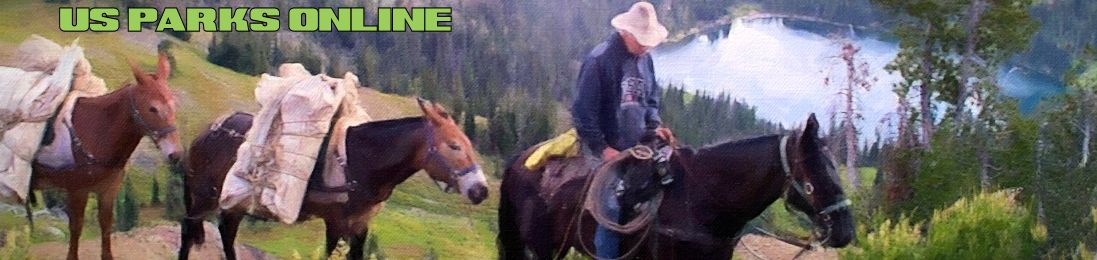
Aravaipa Canyon Wilderness in Arizona has outstanding scenery, desert fish, wildlife, a rich history and opportunities for primitive recreation.
A permit is required in advance to visit Aravaipa Canyon or its side canyons.
Aravaipa Canyon Wilderness
Established: 1984
State: Arizona
Management:
Bureau of Land Management
Acres: 19,410 acres
Nearest Towns:
Mammoth, 20 miles South
Winkelman, 23 miles NW
Phoenix, 120 mi West
Tucson, 70 mi South
This system helps ensure a desirable level of solitude for visitors and reduces the potential for impacts to the environment caused by human use. Canyon use is limited to 50 people per day, 30 from the West end and 20 from the East end.
You should call the BLM at the number below to get a permit and to learn about current conditions in the wilderness.
Know your entry date (and have alternate dates in mind since most weekends and spring and fall days are booked well in advance), exact party size (including children), and the number of days you wish to spend in the canyon.
At the Trailhead
Small dirt parking lots are located at each trailhead. Primitive toilets, trash cans, a visitor registration box, information board, and a self-service fee station are located there. You are required to sign in at the registration box and pay a per day fee. Make checks payable to the Department of the Interior-BLM.
Regulations
1 – Pets are PROHIBITED in Aravaipa Canyon.
2 -Aravaipa Canyon Wilderness is closed to motorized vehicles and equipment.
3 -Cutting or removing vegetation is prohibited.
4 – Pack out all trash, including apple cores and cigarette butts.
5 – Do not disturb wildlife.
6-Access to the west ACW boundary is provided courtesy of The Nature Conservancy. Please respect their private property.
7-Campfires are permitted unless otherwise posted. This may occur during summer fire season.
Expect a Wilderness Experience:
Because a designated wilderness area is to be affected primarily by the forces of nature, the following conditions can be expected when you visit Aravaipa Canyon Wilderness (ACW).
1 – No trails. From the West trailhead (2630), a continuous 430′ elevation gain can be expected over uneven terrain to the East trailhead (3.060′).
Stream wading and numerous stream crossings (up to knee deep), as well as hiking through dense riparian brush can slow travel time.
It would take a strong hiker about 10 hours to hike the length of the canyon.
2 – No facilities. There are no restrooms, picnic tables, or grills within the wilderness. The area is pristine and natural, primitive toilets are located at each trailhead parking lot.
3 – No signs. Once inside the wilderness boundary, there are no directional information, or location signs. Simply note the nine side canyons (see map as you progress to keep track of your approximate location.
Brandenburg Mountain (West ACW) and Booger Canyon (East ACW) 75 minutes.
Topographic maps are sold at map stores, some sporting goods stores, and through the U S. Geological Survey in Denver.
Campsites Outside and Inside the Wilderness
In order to take full advantage of their permit, some parties camp at or near each trailhead the night before their scheduled entry date.
Both parking lots are available for camping, but fires are not permitted.
At the West side, Brandenburg Campsite is identified by a sign along Aravaipa Road. There are no facilities. Fires are allowed.
At the East side, two camping areas are available. Fourmile Canyon Campground, located about one mile southwest of the Klondyke Store (see map), has 10 units with picnic tables and grills. A flush toilet restroom is available. This campground is 10 miles from the trailhead.
At the East trailhead, a primitive road curves to the left and follows Turkey Creek. Camping and fires are permitted in Turkey Creek. There are no facilities.
Camping is permitted anywhere within the wilderness. The BLM requests that you camp well away from the stream or trail, and neither at nor across from side canyons. This improves your safety during flash floods, allows wildlife passage to water, and preserves visitors solitude.
Trailhead Locations
West Trailhead – Access road is suitable for passenger cars year round.
From PHOENIX (120 miles/2 to 2.5 hours).
Take US Highway 60 to Superior. At Superior, take State Highway 177 to Winkelman. At Winkelman, take State Highway 77 11 miles to Aravaipa Road.
Turn left and go 12 miles to the West trailhead along a paved and graded dirt road.
From TUCSON (70 miles/ 1.5 to 2 hours).
Take US Highway 89 to Oracle Junction. At Oracle Junction, take State Highway 77 to the Aravaipa Road. 8 miles north of Mammoth Turn right on Aravaipa Road and go l 2 miles to the West trailhead along a paved and graded dirt road.
East Trailhead – The access road to the East trailhead crosses Aravaipa Creek several times. High clearance vehicles are recommended. Call ahead for road conditions.
From PHOENIX (190 miles/4.5 to 5 hours).
Take US Highway 60 to Globe. At Globe continue on US Highway 70 to the Klondyke Road (8 miles east of Fort Thomas). Take tints graded dirt road 45 miles to the East trailhead.
Several stream crossings will be encountered in the last 10 miles. High clearance vehicles are recommended.
From TUCSON (150 miles/2.5 to 3 hours).
Take Interstate 10 east to Willcox. At Willcox. take exit 340, the Ft. Grant Road (graded dirt) north to Bonita. At Bonita, turn left and continue 40 miles to the East trailhead.
Several stream crossings will be encountered in the last 10 miles. High clearance vehicles are recommended.
For Your Safety
By choosing to enter the wilderness, you assume certain risks. If precautions are taken, many situations can be avoided.
Flash floods occur in the summer and winter rainy seasons. There is no way to predict a flash flood, and water can stay high for hours or days. On sunny days, remember that heavy rains can occur many miles from the area yet still affect Aravaipa Creek.
If you receive a permit during these seasons: Check the forecast for the surrounding area before departure.
Check road conditions if using the East trailhead.
Pay close attention to changing weather conditions. Camp on higher ground away from Aravaipa Creek, and never in or across from the mouth of a side canyon.
Pay attention to the creek-it normally runs clear.
Clouded or muddy water may indicate that the water is rising. Carry extra food in case you become trapped. Tell a friend where you are going and when you will return.
Rattlesnakes
Aravaipa Canyon is home to several species of rattlesnakes. Never put your hands or feet where you cannot see. Remember snakes are generally only aggressive when provoked. They are most active during the day in spring and fall, and in the evenings during summer.
Climate in Aravaipa Canyon
The following chart shows average temperatures for each month:
Jan 61 34
Feb 65 35
Mar 67 38
Apr 78 42
May 87 48
Jun 98 57
Jul 99 67
Aug 96 65
Sep 93 61
Oct 82 48
Nov 69 37
Dec 64 34
In general, the West end is 10 degrees warmer than the East, and the stream temperature is 8 – 10 degrees cooler than the air. Prepare for extreme temperatures.
To avoid heat-related problems in the HOT season, always bring water, sunscreen, lip balm with sunscreen, a light hat with a brim, light cotton clothing, sunglasses, and insect repellent.
To avoid cold-related problems in the cool season, always bring long pants, raingear, a warm hat, gloves, sock liners that wick moisture away, wool socks, and light hiking boots.
Never wear cotton since it has no insulating power, and when wet actually cools the body.
For more information, contact:
Bureau of Land Management
Safford District Office
711 14th Avenue
Safford, AZ 85546
(520) 428-4400