Sequoia and Kings Canyon National Park is known as the Land of Giants for its huge sequoia trees. Located in one of the finest and wildest areas of the Sierra Nevada mountain range in California, you can experience a spectacular range in elevation from warm foothills to cold alpine peaks.
Kings Canyon National Park – Buy this poster
When you arrive, you’ll travel steep highways from the hot, sunny foothills up into cool forests and sequoia groves. If you head out on foot, you can go even higher into the wilderness.
Snow is possible anytime of the year.
Sequoia and Kings Canyon adjoin each other and are managed as one national park. They contain five unique areas: Foothills, Mineral King, Giant Forest & Lodgepole, Grant Grove, and Cedar Grove. Each area has its own climate, features, and highlights. Grant Grove and Giant Forest are the home of the largest sequoia groves.
The Mineral King and Cedar Grove areas are open only in spring through fall, while Grant Grove, Giant Forest, and Lodgepole offer both summer and winter activities. The Foothills area is at a lower elevation and is usually snow free year-round.
The Giant Forest and Lodgepole
Giant sequoia groves grow only on the western slope of the Sierra Nevada, and the Giant Forest may be one of the finest. It’s home to the General Sherman Tree, the world’s largest living tree.
Hiking trails wind through the sequoia grove and meadows. Moro Rock / Crescent Meadow Road leads to features such as Moro Rock, Tunnel Log, and the High Sierra Trail.
The Big Trees Trail that circles a meadow offers an easy hike that’s ideal for families and people in wheelchairs. Giant Forest Museum is open year-round an offers exhibits, park information, and a park store.
Though there are no campgrounds in Giant Forest, there are two seasonal campgrounds nearby in the Lodgepole area.
Besides camping, Lodgepole Village offers a seasonal visitor center, a market and deli, showers, and other services. Wuksachi Lodge and Restaurant are nearby and are open year-round.
Lodgepole trails lead not only to the Giant Forest, and also to alpine lakes and High Sierra views.
On the main park highway from the Sequoia park entrance to the Giant Forest, there is both a vehicle-length restriction of 22 feet and a vehicle-length advisory of 22 feet. The restriction is between the Hospital Rock Picnic Area and the Giant Forest Museum due to road construction.
If your vehicle is longer than that, use the park entrance on Highway 180 to access the Giant Forest via the Grant Grove area. The advisory is between the Foothills Visitor Center and Hospital Rock Picnic Area.
Grant Grove
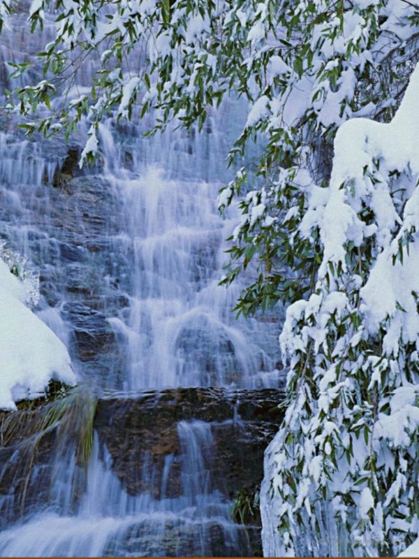
Waterfall, Sequoia and Kings Canyon National Park – Buy this poster
The Grant Grove area was originally General Grant National Park, created in 1890 to protect giant sequoias from logging. Dayhiking opportunities in Grant Grove include trails through a pristine sequoia grove (the General Grant Grove) and one that was logged in the 1880s (the Big Stump Grove).
The Grant Tree Trail leads to the General Grant Tree, the second-largest tree in the world. The accessible Panoramic Point Trail leads to a viewpoint with stunning vistas of wilderness (open only when roads are not snowy).
At 6,600 feet (2,008 m) in elevation, this area is characterized by warm days and cool nights in summer, with deep snow and cold temperatures in winter. Big Stump and Columbine picnic areas become snowplay areas in winter.
Stop by Kings Canyon Visitor Center in Grant Grove Village for exhibits and information, stay at John Muir Lodge or a rustic cabin,or camp at one of three campgrounds near the village.
Other services at the village include lodging, a market, restaurant, showers, post office and gift shop, all open year-round. Nearby, try horseback riding at Grant Grove Stables, where you can join a 1-2 hour guided trip.
Note: The Big Trees Transit shuttle, still mentioned on some websites as operating in the Grant Grove area, is no longer in service.
Cedar Grove
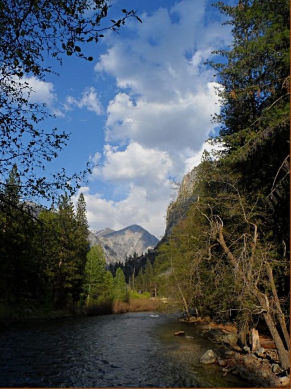
This glaciated valley features towering cliffs, tumbling waterfalls, and the powerful Kings River, whose canyon gave the park its name. Two prominent rock formations, North Dome at 8,717 feet and Grand Sentinel at 8,518 feet, rise 3,500 feet above the canyon floor. Many spectacular wilderness trails originate in the area, especially near Roads End.
Highway 180 to Cedar Grove is open May through October, weather permitting. At 4,600 feet (1,410 m) in elevation, expect warm days and cool nights. At a lower elevation than the sequoia groves, Cedar Grove is warmer in summer.
Hiking trails range from gentle walks along the floor of the canyon or steeper ascents of the canyon’s rims. Features within easy day-hiking distance include Knapps’s Cabin, Canyon View Lookout, Roaring River Falls, Zumwalt Meadow, and Road’s End Permit Station.
Cedar Grove Visitor Center provides trip-planning information and and is a starting point for ranger-led programs and evening programs. Road’s End permit station issues wilderness permits for the many trails that begin here.
At Cedar Grove Village, services include campgrounds and a lodge, market, gift shop, showers, and snack shop. Cedar Grove Pack Station has horseback riding from one-hour trips to multi-day pack trips.
Mineral King
A steep, winding road leads to a place of rugged beauty: Mineral King Valley. At 7800 feet (2375 m), it’s the highest place you can go in these parks by vehicle. The Mineral King subalpine valley consists of both dense forests of pine, sequoia, and fir and colorful granite and shale landscapes.
Mineral King Trails are an excellent way to explore the area, with options that range from the one-mile Cold Springs Nature Loop to wilderness trails that traverse the eastern areas of Sequoia National Park. At Mineral King Ranger Station, get information, trail recommendations, maps, local wilderness permits, first aid, and bear canisters. Wilderness permits are available on the porch of the station when it is closed.
Mineral King is accessed by a 25 mile, steep, winding road open late May through October, weather permitting. RVs and trailers are not recommended. Be prepared; there is no gasoline or electricity in this remote area. This area, at 7,500 to 14,000 feet elevation, is characterized by warm days and chilly nights in summer. In spring and fall, be prepared for freezing temperatures and the possibility of snow. Two seasonal campgrounds are for tent camping only.
Silver City Mountain Resort has lodging that includes chalets and rustic cabins, a small market with limited supplies, showers, and restaurant that is popular for its selection of pie. There is no ice or gasoline. It’s on Mineral King road, 3 miles west of the ranger station.
Marmots are active here and precautions are recommended to protect your vehicle from damage, especially in spring and early summer.
The Foothills

Sequoia Trees, Sequoia and Kings Canyon National Park – Buy this poster
Just inside the entrance to Sequoia National Park is a diverse landscape ruled by the seasons. In winter and spring, rain awakens plants and wildflowers, creating a hiker’s paradise of green hills and moderate temperatures. In summer, hot and dry conditions dominate. Hiking trailshere follow the Kaweah River and its tributaries.
Stop by Foothills Visitor Center one mile from the park entrance, or camp in one of the two foothills campgrounds to get a closer look. There are picnic areas at Foothills Visitor Center and at Hospital Rock, which also has outdoor exhibits.
If you plan to drive from the Foothills to the Giant Forest, be aware that vehicles over 22 feet long are prohibited along this winding and narrow stretch of the Generals Highway. Longer vehicles should use the Kings Canyon National Park entrance on Highway 180.
Sequoia & Kings Canyon’s Wilderness
Over 95% of these parks is designated as wilderness. Here you can climb the highest peaks and see some of the most rugged country in our national parks. Not all wilderness hikes are challenging; gentle trails lead into wilderness areas, too. Before you hike, check information about trail safety. Wilderness permits are required for overnight trips.
National Forests
Two national forests border the national parks: Sequoia National Forestand Sierra National Forest. These lands offer a variety of uses, including some that are not allowed on national park land. The forests also offer camping, lodging, food, and gasoline.