Although first afforded Federal protection in 1893 as a Forest Reserve and later as a National Monument, the Grand Canyon did not achieve National Park status until 1919, three years after the creation of the National Park Service. Today Grand Canyon National Park receives close to five million visitors each year.

Grand Canyon National Park – Buy this print
Grand Canyon National Park, a World Heritage Site, encompasses 1,218,375 acres and lies on the Colorado Plateau in northwestern Arizona.
The land is semi-arid and consists of raised plateaus and structural basins typical of the southwestern United States.
Drainage systems have cut deeply through the rock, forming numerous steep-walled canyons. Forests are found at higher elevations, while the lower elevations are made up of a series of desert basins.
Well known for its geologic significance, the Grand Canyon is one of the most studied geologic landscapes in the world. It offers an excellent record of three of the four eras of geological time, a rich and diverse fossil record, a vast array of geologic features and rock types, and numerous caves containing extensive and significant geological, paleontological, archeological and biological resources.
It is considered one of the finest examples of arid-land erosion in the world. The Canyon, incised by the Colorado River, is immense, averaging 4,000 feet deep for its entire 277 miles. It is 6,000 feet deep at its deepest point and 18 miles at its widest. However, the significance of Grand Canyon is not limited to its geology.
History & Culture
The oldest human artifacts found in the canyon are nearly 12,000 years old and date to the Paleo-Indian period. There has been continuous use and occupation of the park since that time.
The park has recorded over 4,300 archeological resources with an intensive survey of over 5% of the park area.
The park’s 11 Traditionally Associated Tribes and historic ethnic groups view management of archeological resources as preservation of their heritage.
Archeological remains from the following culture groups are found in Grand Canyon National Park: Paleo-Indian, Archaic, Basketmaker, Ancestral Puebloan (Kayenta and Virgin branches), Cohonina, Cerbat, Pai, Southern Paiute, Zuni, Hopi, Navajo, and Euro-American.
Plants & Wildlife
The Park contains several major ecosystems. Its great biological diversity can be attributed to the presence of five of the seven life zones and three of the four desert types in North America.
The five life zones represented are the Lower Sonoran, Upper Sonoran, Transition, Canadian, and Hudsonian. This is equivalent to traveling from Mexico to Canada.
The Park also serves as an ecological refuge, with relatively undisturbed remnants of dwindling ecosystems (such as boreal forest and desert riparian communities). It is home to numerous rare, endemic (found only at Grand Canyon), and specially protected (threatened or endangered) plant and animal species.
Over 1,500 plant, 355 bird, 89 mammalian, 47 reptile, 9 amphibian, and 17 fish species are found in park. These include golden eagles, bald eagles, California Condor, bass, trout, catfish, mountain lion, dall sheep, bighorn sheep, elk, bison, mule deer, javalina, bobcat, fox, badger, black bear, porcupine, gila monsters, skunks, and rattlesnakes, to name a few.
Things to Do on the South Rim and Desert View (Open All Year)
Attend Free Ranger Programs
Learn more about the the nature, science, history and culture of Grand Canyon with a park ranger as your guide.
Stop by the visitor center or one of the museums
The South Rim offers a variety of museums and information centers that house exhibits and provide park information.
Watch the park orientation film:
Grand Canyon: A Journey of Wonder, shown at the Grand Canyon Visitor Center.
The movie is 20 minutes long and starts on the hour and half-hour. The first showing begins at 9 am and the last showing is at 4 pm daily.
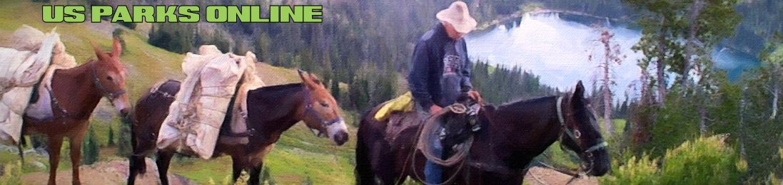
South Rim Mule Trips are offered year round.
Visit Xanterra’s website for more details and to book a trip. Or call (303) 297-2757 or toll free (888) 297-2757.
Walk the Trail of Time
between Yavapai Museum of Geology and Verkamps Visitor Center 1.2 miles (2 km) along the canyon rim. The Trail of Time is an interpretive walking timeline trail that focuses on Grand Canyon vistas and rocks to guide visitors to ponder, explore, and understand the magnitude of geologic time and the stories encoded by Grand Canyon rock layers and landscapes.
The Scenic and Historic Hermit Road

Grand Canyon from the Hermit Rim Road – Buy this print
During the busy season, between March 1st and November 30 of each year, free shuttle buses operate on Hermit Road and the road is closed to private vehicles. Commercial bus tours are also available.
During the winter months of December, January and February, Hermit Road is open to all vehicles. Winter visitors should be advised that the road can close with little notice, particularly in the evenings, as refreezing snow melt creates the potential for black ice.
Improved in 2008, Hermit Road (formerly known as the West Rim Drive) has some of the best Grand Canyon views that you can see anywhere. Once you get out to Hopi Point, the Colorado River comes into view, and on a quiet day at Pima Point, you can hear the roar of the Colorado River as it crashes through Granite Rapid.
Nine months of the year, access is by commercial tour bus or free park shuttle bus, which gives you the chance to look at the scenery, while someone else does the driving. (March 1 through November 30.)
The shuttle buses are great when you use them in conjunction with the rim trail – you can get off at one stop, enjoy a scenic walk along the rim, and then get back on the bus at the next stop.
If you feel like taking a longer walk, fill a backpack with food and water, then take the shuttle bus out to Hermit’s Rest and day hike the Canyon Rim Trail the 8 miles (11 km) back to the Village.
If you enjoy bicycling, Hermit Road is probably the best place in the park. There is far less traffic out here because of the limitations on private vehicles. The three miles of Greenway Trail are also a great addition for cyclists as well as hikers.
Take a trip out on the Scenic Desert View Drive
East of Grand Canyon Village, tour in your private vehicle or by commercial bus tour 25 miles (42 km) one-way. Views of the river at Moran, Lipan and Desert View Points. You may exit or enter the park to the east. (via Arizona highways 64 and 89).
At Desert View Point, the Watchtower is the official visitor contact station. Climb 85 steps to the top of a 70 ft. tall (21.5 m) stone Watchtower for a panoramic view that extends for more than 100 miles on a clear day. The historic Watchtower is a replica of the prehistoric towers found on the Colorado Plateau and was designed in 1932 by legendary architect, Mary Jane Colter.
The nearby Tusayan Museum and Ruins highlights the story of American Indians of the region. Tusayan Ruin is the remains of a small Ancestral Puebloan village located 3 miles (5 km) west of Desert View. This was a thriving community that created pottery, arrowheads and other household artifacts.
View 2,000–4,000 year old artifacts along with traditional handicrafts made by regional tribes. Walk the relatively flat 0.1 mile (200 m) self-guiding trail around the site. Admission is free. Hours: 9 am to 5 pm
Whitewater and Smoothwater raft trips on the Colorado River
Whitewater trips through Grand Canyon last from 3 days to 21 days and require reservations well in advance. Half-day smoothwater trips from Glen Canyon Dam to Lees Ferry may be arranged by any Lodge in the park transportation from park lodges to the Dam is included.
Participate in a Grand Canyon Association Field Institute Learning Adventure
The Grand Association Canyon Field Institute offers guided educational tours led by expert instructors while backpacking, camping, hiking, and whitewater rafting. Topics include geology, history, archaeology, photography, and more.
Journey to Grand Canyon National Park aboard Grand Canyon Railway
From Williams, Arizona (along Interstate 40) the Grand Canyon Railway carries more than 230,000 people by rail to Grand Canyon National Park each year.

Under the Red Wall, Grand Canyon National Park, Arizona – Buy this print
The North Rim (has a short season) May 15 through October 15 each year.
The North Rim Is harder to get to, and is more wild and secluded.North Rim restaurants, lodging and store are open from May 15 through October 15 of each year. Reservations are strongly recommended.
Additional facilities are available in the surrounding Kaibab National Forest, the Kaibab Lodge area, and Jacob Lake.
The North Rim is over 8000 feet/2438 m. in elevation. Visitors with respiratory or heart problems may experience difficulties. Walking at this elevation can be strenuous.
“Shoulder Season” visits to the North Rim :
There is a dawn to dusk day use period – with limited services – beginning after the lodge closes on October 15 and lasting through November 30, or until snow closes highway 67 – whichever happens first.
Even though it is not possible to drive vehicles to the North Rim during the winter, hikers, snowshoers and cross country skiers are able to enter the North Rim of the park through the winter months, provided backcountry permits have been obtained. Personal snowmobiles are not permitted inside the park. The North Rim reopens on May 15 of every year.
The North Rim Visitor Center is located adjacent to the parking lot on Bright Angel Peninsula. This is a great place to start your adventure on the North Rim. Speak with a ranger who will be happy to help with questions you may have about the area. The Visitor Center also features interpretive exhibits, maps, brochures and a bookstore.
North Rim Mule Rides
are offered May 15th through Oct. 15th.
♦ North Rim mule trips do not go to the Colorado River.
♦ One-hour rides along the rim and ½ day rim or inner canyon trips are usually available on a daily basis.
Restrictions:
Free Interpretive Ranger Programs
are offered daily throughout the season; between May 15th and October 15.
Take a day hike through this beautiful scenery. Experience the wild and remote feeling of the North Rim. Solitude can be found hiking the trails, and enjoying an awe-inspiring view. Watch mule deer and turkeys feeding in mountain meadows. Enjoy, discover, and celebrate the unique world of the North Rim.
Tour the North Rim Scenic Drive
During the season, Point Imperial and Cape Royal are reached via a winding scenic drive. Driving to both points, with short walks at each and several stops at pullouts along the way, can take half a day. Point Imperial is 11 miles/ 18km – 20 min. one way. Cape Royal is 23 miles/ 37km – 45 min. one way.
Trails & Hiking
Many people flock to the Grand Canyon to take in its splendor but only a few of the more adventurous choose to view it via a hike.
The canyon offers hiking adventures for every skill level: from a rim-side stroll to a demanding hike below the rim on wilderness trails. No two trails are alike; each has its own merits, obstacles, challenges, and colorful history.
Just like any other outdoor experience, research, preparation, and selecting a suitable route for your skills and condition is essential to make your hike at the Grand Canyon a rewarding and unforgettable adventure.
South Rim Trails
Boucher Trail
Elevation: 5,280 feet (1,609 m) Boucher trailhead at junction with the Dripping Springs Trail
Elevation: 2,330 feet (710 m): Boucher Rapid
Length:10.5 miles (16.9 km): Hermit trailhead to Boucher Rapid
Length: 9.5 miles (15.3 km): Dripping Springs Trail junction to Boucher Rapid
Part-time hermit Louis Boucher first came to the canyon in 1891 and soon began guiding tourists and prospecting for mineral deposits. He built a camp at Dripping Springs and a cabin near his copper mine in Boucher Canyon where he planted an orchard of 75 fruit trees. Remains of the cabin are still visible on the east side of Boucher Creek.
Washouts and rockslides require some route-finding skill. Hot and dry in summer. Stash water on way in for use on way out. Use instep crampons in winter.
Bright Angel Trail

Bright Angel Trail, Grand Canyon, Arizona – Buy this print
Elevation: 6,860 feet (2,091 m): Bright Angel trailhead
Elevation: 3,800 feet (1,158 m): Indian Garden
Elevation: 3,740 feet (1,140 m): Plateau Point
Elevation: 2,480 feet (756 m): Colorado River
Length: 4.6 miles (7.4 km): Bright Angel trailhead to Indian Garden
Length: 6.1 miles (9.8 km): Bright Angel trailhead to Plateau Point
Length: 7.8 miles (12.6 km): Bright Angel trailhead to the Colorado River
Length: 9.3 miles (15 km): Bright Angel trailhead to Bright Angel Campground
Corridor Trail, Well maintained and well marked.
Since prehistoric times, American Indians have used the natural route along the fault line to enter the inner canyon and reach the springs at American Indian Garden. Indian pictographs may be seen above past the first tunnel and above the trail between Mile-and-a-Half Resthouse and Two-Mile Corner.
Miners improved the trail in 1891 and began charging a toll for others to use it. Private citizens, the Santa Fe Railway, and government officials contested ownership of the Bright Angel Trail from 1901 to 1928, when control finally passed to the National Park Service.
Havasupai families still farmed at Indian Garden around the turn of the century.
NOTE: Mule riders take day trips down the trail. When a mule party approaches, stand quietly to the inside of the trail until it has passed. Mules have the right-of-way.
Escalante Route
Elevation: 2,600 feet (823 m): Colorado River
Elevation: 3,800 feet (1187 m): Escalante Creek ridge
Length: 15 miles (24 km): from the Tanner Trail to the New Hance Trail
Wilderness Trail with washouts and rockslides, requires some route-finding skill. Hot and dry in summer. No water except at the river. Stash water on way in for use on way out. Use instep crampons in winter.
This rugged route presents difficulties not normally encountered along the Tonto Trail. Several sections require exposed hand-and-toe climbing and vertical pack handling. For experienced Grand Canyon hikers only.
Grandview Trail
Elevation: 7,400 feet (2,256 m): Grandview trailhead
Elevation: 4,800 feet (1,463 m): Horseshoe Mesa
Elevation: 3,760 feet (1,146 m): Tonto Trail junction
Length:3 miles (4.8 km): Grandview trailhead to Horseshoe Mesa
Length: 4.8 miles (7.7 km): Grandview trailhead to Tonto Trail junction via East Horseshoe Mesa Trail
Hopi Indians gathered mineral paints on Horseshoe Mesa long before Pete Berry began working the Last Chance Mine in 1890.
Berry built a trail to his copper mine and used burros to pack the ore to the rim. The copper tested high grade, but transportation costs cut into his profits.
When tourism increased, Berry built the Grandview Hotel on the rim and began guiding sightseers into the canyon along his trail. All mining ended on the mesa in 1908.
Wilderness Trail with washouts and rockslides, require some route-finding skill. Hot and dry in summer. Stash water on way in for use on way out. Use instep crampons in winter.
WARNING: Do not enter the mine shafts. Most are unstable and some contain vertical shafts. Radon levels in the mines register many times above normal levels.
Prehistoric and historic artifacts found within the park are protected by law. Leave them for others to enjoy.
Hermit Trail
Elevation: 6,640 feet (2,024 m): Hermit trailhead
Elevation: 4,880 feet (1,487 m): Santa Maria Springs
Elevation: 2,400 feet (732 m): Colorado River
Length: 2.5 miles (4.0 km): Hermit trailhead to Santa Maria Springs
Length: 7.8 miles (12.6 km): Hermit trailhead to Hermit Creek
Length: 9.3 miles (15.0 km): Hermit trailhead to Colorado River
The Santa Fe Railway began developing the Hermit Canyon area so that travelers could avoid paying tolls on the Bright Angel Trail. A tramway from Pima Point supplied the tourist camp in Hermit Canyon.
Wilderness Trail with washouts and rockslides, require some route-finding skill. Hot and dry in summer. Stash water on way in for use on way out. Use instep crampons in winter.
NOTE: Overnight hikers must camp in designated campsites at Hermit Creek and Hermit Rapid. Allow 7 hours to reach Hermit Creek. The trail is rocky and steep, and requires very slow walking.
New Hance Trail
Elevation: 7,000 feet (2,134 m): New Hance trailhead
Elevation: 2,600 feet (792 m): Colorado River
Length: 8 miles (12.9 km): New Hance trailhead to the Colorado River
An outcropping of Precambrian schist near Hance Rapid marks the beginning of Granite Gorge, an area of concern to early river runners because of dangerous rapids and difficult portages.
Hakatai Shale forms the distinctive red rock along the lower stretch of Red Canyon. The east end of the Tonto Trail begins at the mouth of Red Canyon.
John Hance, famous canyon guide and storyteller, arrived at the South Rim around 1883. Hance first built a trail down Hance Creek to the west, following a Havasupai Indian route.
When his original trail washed out, he relocated it to its present location in Red Canyon.
“You must understand,” Hance once warned a tourist, “that when you get to the bottom of the canyon and reach the shore of the Colorado River it is very warm. You can’t imagine how hot it is.
Why, I’ll give my word, I’ve been down there when it was so hot it melted the wings off the flies.” “But,” asked an incredulous lady from New England, “how do the tourists stand it?”
“Madame,” Hance replied, “I have never yet seen a tourist with wings!”
Wilderness Trail with washouts and rockslides, require some route-finding skill. Hot and dry in summer. Stash water on way in for use on way out. Use instep crampons in winter.
South Bass Trail
Elevation: 6,650 feet (2027 m): South Bass trailhead
Elevation: 2,250 feet (686 m): Colorado River
Length: 7.8 miles (12.6 km): South Bass trailhead to the Colorado River
Archaeological evidence shows that prehistoric Cohonina Indians used this route, followed in more recent times by Havasupai Indians.
Canyon pioneer William Bass improved the American Indian footpaths for horseback travel. Bass developed a tourist camp on the South Rim and a winter camp and mines on the north side of the Colorado River.
Initially, he guided sightseers across the river by boat and then by cable crossing (now dismantled) to reach his trail leading to the North Rim.
To do the laundry during dry spells, his wife, Ada Bass, would bundle up the family’s dirty clothes and saddle her horse for a three-day trip to the river and back.
In 1915, a river party abandoned their metal boat, the Ross Wheeler, which still lies at the foot of the Bass Trail.
Wilderness Trail with washouts and rockslides, require some route-finding skill. Hot and dry in summer. Stash water on way in for use on way out. Use instep crampons in winter.
South Kaibab Trail
Elevation: 7,260 feet (2,213 m): South Kaibab trailhead
Elevation: 6,320 feet (1,926 m): Cedar Ridge
Elevation: 2,480 feet (756 m): Colorado River
Length: 1.5 miles (2.4 km): South Kaibab trailhead to Cedar Ridge
Length: 6.3 miles (10.1 km): South Kaibab trailhead to the Colorado River
Length: 7.3 miles (11.7 km): South Kaibab trailhead to Bright Angel Campground
The National Park Service completed the cross-canyon “corridor” trail system in 1928—the same year it took control of the Bright Angel Trail.
Most trails in Grand Canyon stay within the confines of a side canyon. But the South Kaibab is one of the few trails to follow open ridgelines that provide panoramic views of the main gorge.
Corridor Trail, well maintained and well marked.
Tanner Trail
Elevation: 7,300 feet (2,225 m): Tanner trailhead
Elevation: 5,600 feet (1,707 m): Escalante Saddle
Elevation: 2,700 feet (823 m): Colorado River
Length: 3 miles (4.8 km): Tanner trailhead to Escalante Butte
Length: 10 miles (16.1 km): Tanner trailhead to the Colorado River
Seth Tanner, an early Mormon pioneer, improved this prehistoric Indian footpath in the 1880s. His pack trail provided access to mining claims along the river in the Palisades Creek area.
At one time the route was part of the Horsethief Trail. Outlaws stole horses in Utah and drove them down the Nankoweap Trail to a low-water ford across the Colorado River. After altering brands, they moved the horses up the Tanner Trail to the South Rim and sold them farther south to unsuspecting ranchers.
Beamer Trail
About 9.5 miles (15.3 km) from Tanner Beach to the mouth of the Little Colorado River (LCR).
Generally the route follows near the river as far as Palisade Creek, then climbs via cairned switchbacks to the top of the Tapeats Sandstone and follows this narrow bench to the LCR.
No camping is allowed within 0.25 mile of the LCR/Colorado River junction.
Tonto Trail
Elevation: 3,600 feet (1,097 m): Tonto Platform (Red Canyon)
Elevation: 2,800 feet (853 m): Tonto Platform (Garnet)
Length: 95 miles (152.9 km): Garnet Canyon to Red Canyon
Hikers seldom follow the entire Tonto Trail, normally using it to connect with rim-to-river routes.
Approximate mileages between key points on the Tonto Trail:
11.6 miles (18.7 km): Garnet Creek to Bass Canyon
35.7 miles (57.5 km): Bass Canyon to Hermit Creek
12 miles (19.3 km): Hermit Creek to Bright Angel Trail (Indian Garden)
4.5 miles (7.2 km): Bright Angel Trail to South Kaibab Trail
21.3 miles (34.3 km): South Kaibab Trail to Grandview Trail (Horseshoe Mesa)
9.9 miles (15.9 km): Grandview Trail to New Hance Trail (Red Canyon)
North Rim Trails

Grand Canyon, Arizona – Buy this print
Clear Creek Trail
Elevation: 2,640 feet (805 m): Clear Creek trailhead
Elevation: 4,160 feet (1268 m): Tonto Platform
Elevation: 3,440 feet (1,049 m): Clear Creek
Length: 8.7 miles (14 km): Clear Creek trailhead to Clear Creek
The Civilian Conservation Corps built the trail to Clear Creek in 1933. The northeast arm of Clear Creek Canyon, north of Honan Point, contains the highest waterfall in the Grand Canyon.
Most times of the year, Cheyava Falls is a mere trickle, but after a wet winter it gushes from the cliff face in a series of cascades.
The Kolb brothers, early canyon photographers, first explored Cheyava Falls in 1903 after a prospector spotted what he thought was a cliff coated with a sheet of ice.
A day hike down Clear Creek to the river involves frequent stream crossings. A climb is required to bypass a 15-foot (4.6 m) pouroff, 0.25 mile (0.40 km) from the river.
To reach seasonal (snowmelt-fed) Cheyava Falls, follow Clear Creek north from Clear Creek Campground for 5 miles. Several stream crossings are required; there is no established trail.
Nankoweap Trail
Elevation: 8,800 feet (2,682 m): FS Trail 57 at FS610 roadhead
Elevation: 7,560 feet (2,304 m): National Park Service trailhead at Saddle Mountain Saddle
Elevation: 2,760 feet (841 m): Colorado River
Length: 14.5 miles (23.3 km): FS610 roadhead to Colorado River
Length: 14 miles (22.5 km): FS445 roadhead to Colorado River
Length: 11 miles (17.7 km): National Park Service trailhead (Saddle Mountain saddle) to Colorado River
In 1882, canyon explorer and geologist John Wesley Powell directed the building of a trail into Nankoweap Valley that followed a Paiute route. His colleague, geologist Charles Walcott, used it to reach isolated rock formations in the eastern Grand Canyon.
Kolb Arch, the largest natural bridge in the canyon, is found in an upper arm of Nankoweap Canyon below Woolsey Point.
Wilderness Trail with washouts and rockslides, require some route-finding skill. Hot and dry in summer. Stash water on way in for use on way out. Use instep crampons in winter.
North Bass Trail
Elevation: 7,500 feet (2,286 m): North Bass trailhead (Swamp Point)
Elevation: 2,200 feet (671 m): Colorado River
Length: 14 miles (22.5 km): North Bass trailhead to the Colorado River
When his doctor gave William Bass only a few years to live, Bass headed west in a desperate attempt to regain his health.
He made friends with Havasupai Indians who guided him into remote parts of the canyon where he began developing several mines. The trails Bass constructed to these claims proved valuable when his tourist business grew.
The guide built a camp along Shinumo Creek with orchards and a garden to supply his family and tourist operation on the South Rim. Bass outlived his doctor’s prediction by half a century.
Wilderness Trail with washouts and rockslides, require some route-finding skill. Hot and dry in summer. Stash water on way in for use on way out. Use instep crampons in winter.
North Kaibab Trail
Elevation: 8,250 feet (2,515 m): North Kaibab trailhead
Elevation: 5,200 feet (1,585 m): Roaring Springs
Elevation: 4,080 feet (1,244 m): Cottonwood Campground
Elevation: 2,400 feet (732 m): Colorado River
Length: 4.7 miles (7.6 km): North Kaibab trailhead to Roaring Springs
Length: 6.8 miles (11 km): North Kaibab trailhead to Cottonwood Campground
Length: 14.2 miles (22.9 km): North Kaibab trailhead to the Colorado River
American Indians and prospectors originally used a route now followed by the Old Kaibab Trail. Mapmaker Francois Matthes improved the trail during his Grand Canyon survey in 1902.
A year later, David Rust established a tourist camp at the mouth of Bright Angel Creek. Rust constructed a cable crossing over the Colorado River a few years later, linking the North and South Rims.
The Fred Harvey Company acquired Rust’s holdings and built Phantom Ranch, a tourist lodge named after nearby Phantom Creek.
Well maintained and well marked.
Variation:Old Bright Angel Route: 7.8 miles (12.6 km) long. The trail can be reached from the North Kaibab trailhead by following the Ken Patrick Trail. Good route-finding skills are required for this unmaintained route.
The old trail descends a series of steep switchbacks in the upper canyon cliffs. Scrub oak thickets obscure the upper portion of the trail, but conditions improve as it descends.
The trail bypasses a pouroff at the top of the Redwall cliff by climbing to the right (west) and leading to a steep break.
After reaching Bright Angel Creek, the trail stays above the creek bed on the west side to avoid brush and boulders. About 0.5 mile (0.8 km) before reaching the junction with Roaring Springs Canyon, the trail crosses to the east side.
Thunder River Trail / Deer Creek Trail
Elevation: 6,400 feet (1,950 m): Thunder River trailhead
Elevation: 7,200 feet (2,194 m): Bill Hall trailhead
Elevation: 2,000 feet (609 m): Colorado River
Length: 15 miles (24 km): Thunder River trailhead (Indian Hollow) to the Colorado River
Length: 12 miles (19.3 km): Bill Hall trailhead (Monument Point) to the Colorado River
Rumors of placer gold drew miners into the area in 1876. They constructed the upper portions of the trail, used by geologist Clarence Dutton several years later.
Crews built the present trail into Tapeats Creek in 1926. Thunder River, one of the world’s shortest rivers, flows for only 0.5 mile (0.8 km) before entering Tapeats Creek.
Wilderness Trail with washouts and rockslides require some route-finding skill. Hot and dry in summer. Stash water on way in for use on way out. Use instep crampons in winter.
Variations: Deer Creek Trail
Once in Surprise Valley, the Deer Creek Trail branches west (right) into Deer Creek Valley. Entering a deep narrows, the trail traverses a ledge on the west side. Leaving the narrows, it descends a talus slope to the base of the waterfall and the Colorado River.
Other Locations
Havasu Trail
Elevation: 5,200 feet (1,625 m): Hualapai Hilltop trailhead
Elevation: 3,200 feet (1,000 m): Supai Village
Elevation: 2,380 feet (745 m): Beaver Falls
1,866 feet (583 m): Colorado River
Length: 8 miles (13 km): to Supai Village
Length: 9.5 miles (15.3 km): to Navajo Falls
Length: 10 miles (16 km): to Campground and Havasu Falls
Length: 11 miles 17.7 km): to Mooney Falls
Length: 13 miles (21 km): to Beaver Falls
Length: 17 miles (27 km): to Colorado River
Havasu Canyon is not in Grand Canyon National Park, but is a popular stop while you are in the area. To learn more about hiking, permits, and access please visit http://theofficialhavasupaitribe.com/
Wilderness Trail with washouts and rockslides, require some route-finding skill. Hot and dry in summer. Stash water on way in for use on way out. Use instep crampons in winter.