Shenandoah National Park is a beautiful, historic national treasure which includes the 105-mile long Skyline Drive, a National Scenic Byway. The Park covers the crest of Virginia’s Blue Ridge Mountains for over seventy-five miles. The Appalachian Trail roughly parallels the Skyline Drive and 101 miles of this trail run through the Park.

Skyline Drive curves around mountaintops and pushes through clouds at Shenandoah National Park in Virginia. With plenty of spots to pull off and take in the view, it’s the perfect place to enjoy a mountain sunrise. Photo by N. Lewis, National Park Service.
Shenandoah National Park is located in northwestern Virginia, northwest of Charlottesville, Virginia. The Park is approximately 75 miles west of Washington, DC and the Headquarters office is located 3.0 miles west of Thornton Gap and 4.0 miles east of Luray, Virginia on U.S. 211.
These mountains form a distinct highland rising to elevations above 4,000 feet (1,200 m). Local topographic relief between the Blue Ridge Mountains and Shenandoah Valley exceeds 3,000 feet (910 m) at some locations.
The crest of the range divides the Shenandoah River drainage basin, part of the Potomac River drainage, on the west side, from the James and Rappahannock River drainage basins on the east side.[3]
Some of the rocks exposed in the park date to over one billion years in age, making them among the oldest in Virginia.
There are over 500 miles of hiking trails, numerous waterfalls and mountain summits. The trail circles through an old-growth forest of magnificent hemlocks and includes a 65 foot bridge and 150 foot boardwalk.
Shenandoah National Park lies astride a beautiful section of the Blue Ridge, which forms the eastern rampart of the Appalachian Mountains between Pennsylvania and Georgia.
In the valley to the west is the Shenandoah River, from which some feel the Park gets its name, and between the north and south forks of the river is Massanutten, a 40-mile-long mountain.
To the east is the rolling Piedmont country providing vistas of the spectacular landscape is Skyline Drive, a winding road that runs along the crest of this portion of the Blue Ridge Mountains through the length of the Park.
Park Ranger programs are offered seasonally and a current list is provided online and available in the “Shenandoah Explorer” newspaper that you receive when you enter the park.
There are full-service restaurants at Skyland and Big Meadows plus there are “waysides” with lighter food.
The closest major airports are in Washington, DC (90 miles), Charlottesville (50 miles) and Weyers Cave (45 miles), Virginia.
Since there are no bus, taxi or shuttle services through the Park, a car is needed. Accessible by I-66 and Highway 340 South to the north entrance at Front Royal, Highway 211 for the central entrance at Thornton Gap, Highway 33 at Swift Run Gap and I-64 at the Rockfish Gap entrance. Speed limit for the Skyline Drive is 35mph.
History of Shenandoah National Park
Legislation to create a national park in the Appalachian mountains was first introduced by new Virginia congressman Henry D. Flood in 1901, but despite the support of President Theodore Roosevelt, failed to pass.
In May 1925, Congress and President Calvin Coolidge authorized the NPS to acquire a minimum of 250,000 acres and maximum of 521,000 acres to form Shenandoah National Park.
However, the legislation also required that no federal funds would be used to acquire the land. Thus, Virginia needed to raise private funds, and could also authorize state funds and use its eminent domain (condemnation) power to acquire the land to create Shenandoah National Park.
Virginia’s Democratic gubernatorial candidate (and the late Congressman Flood’s nephew), Harry F. Byrd supported creation of Shenandoah National Park, as did his friend William E. Carson, a businessman who had become Virginia’s first chairman of the Commission on Conservation and Development.
The land that became Shenandoah park was scenic, mountainous, and had also lost about half of its trees to the Chestnut blight (which was incurable and affected trees as they reached maturity). However, it had been held as private property for over a century, so many farms and orchards existed.
After Byrd became governor and convinced the legislature to appropriate $1 million for land acquisition and other work, Carson and his teams (including surveyors and his brother Kit who was Byrd’s law partner) tried to figure out who owned the land.
They found that it consisted of more than 5,000 parcels, some of them inhabited by tenant farmers or squatters (who were ineligible to receive compensation).
Some landowners, including wealthy resort owner George Freeman Pollock and Luray Realtor and developer L. Ferdinand Zerkel, had long wanted the park created and had formed the Northern Virginia Park Association to win over the national park selection committee.
However, many local families who had lived in the area for generations (especially people over 60 years old) did not want to sell their land, and some refused to sell at any price.
Carson promised that if they sold to the state, they could still live on their homesteads for the rest of their lives.
Carson also lobbied the new President Herbert Hoover, who bought land to establish a vacation fishing camp near the headwaters of the Rapidan River (and would ultimately donate it to the park as he left office; it remains as Rapidan Camp).
The Commonwealth of Virginia slowly acquired the land through eminent domain, and then gave it to the U.S. federal government to establish the national park. Carson’s brother suggested that Virginia’s legislature authorize condemnation by counties (followed by arbitration for individual parcels) rather than condemn each parcel.
Some families accepted the payments because they needed the money and wanted to escape the subsistence lifestyle. Nearly 90% of the inhabitants worked the land for a living selling timber, charcoal or crops.
They had previously been able to earn money to buy supplies by harvesting the now-rare chestnuts, by working during the apple and peach harvest season (but the drought of 1930 devastated those crops and killed many fruit trees), by selling handmade textiles and crafts (displaced by factories) and moonshine (illegal after Prohibition started).

River in Shenendoah National Park
However, Carson and the politicians did not seek citizen input early in the process, nor convince residents that they could live better in a tourist economy. Instead they started with an advertising campaign to raise the funds, and courthouse property evaluations and surveys.
Upon Mather’s death in 1929, the new NPS director, Horace M. Albright also decided that the federal agency would only accept vacant land, so even elderly residents would be forced to leave. Thus, many families and entire communities were forced to vacate portions of the Blue Ridge Mountains in eight Virginia counties.
Although the Skyline Drive right-of-way was purchased from owners without condemnation, the costs of the acreage purchased trebled over initial estimates and the acreage decreased to what Carson called a “fish-bone” shape and others a “shoestring.”
Although Byrd and Carson convinced Congress to reduce the minimum size of Shenandoah Park to just over 160,000 acres to eliminate some high-priced lands, in 1933 newly elected President Franklin D. Roosevelt decided to also create the Blue Ridge Parkway to connect to then-under-construction Skyline Drive on the Shenandoah National Park ridgeline, which required additional condemnations.
When many families continued to refuse to sell their land in 1932 and 1933, proponents changed tactics. Freeman hired social worker Miriam Sizer to teach at a summer school he had set up near one of his workers’ communities, and asked her to write a report about the conditions in which they lived.
Although later discredited, it depicted the local population as very poor and inbred, and was soon used to support forcible evictions and burning of former cabins so residents would not sneak back.
University of Chicago sociologists Fay-Cooper Cole and Mandel Sherman described how the small valley communities or hollows had existed “without contact with law or government” for centuries, which some analogized to a popular comic strip Lil Abner and his fictional community Dogpatch.
In 1933, Sherman and journalist Thomas Henry published Hollow Folk drawing pitying eyes to local conditions and “hillbillies.”
As in many rural areas of the time, most remote homesteads in the Shenandoah lacked electricity and often running water, as well as access to schools and health facilities during many months.
However, Hoover had hired experienced rural teacher Christine Vest to teach near his summer home (and who believed the other reports exaggerated, as did Episcopal missionary teachers in other Blue Ridge areas).
Carson had had ambitions to become governor in 1929 and 1933, but Byrd instead selected George C. Peery of the state’s southwest corner to succeed easterner Pollard. After winning election, Peery and Carson’s successor would establish Virginia’s state park system, although plans to relocate reluctant residents kept changing and basically failed.
Carson had hoped to head that new state agency, but was not selected because of his growing differences with Byrd, over fees owed his brother and especially over the evictions that began in late 1933 against his advice but pursuant to new federal policies and that garnered much negative publicity.
Most of the reluctant families came from the park’s central counties (Madison, Page, and Rappahannock), not the northern counties nearest Byrd’s and Carson’s bases, nor from the southern end where residents could see tourism’s benefits at Thomas Jefferson’s Monticello since the 1920s, as well as the jobs available in the Shenandoah and new Blue Ridge projects.
In 1931 and 1932, residents were allowed to petition the state agency to stay another year to gather crops, etc. However, some refused to cooperate to any extent, others wanted to continue to use resources now protected (including timber or homes and gardens vacated by others), and many found the permit process arbitrary.
Businessman Robert H. Via filed suit against the condemnations in 1934 but did not prevail (and ended up moving to Pennsylvania and never cashed his condemnation check).
Carson announced his resignation from his unpaid job effective in December 1934. As one of his final acts, Carson wrote the new NPS director, Arno B. Cammerer, urging that 60 people over 60 years old whose plots were far and not visible from the new Skyline Drive not be evicted.
When evictions kept creating negative publicity in 1935, photographer Arthur Rothstein coordinated with the Hollow Folk authors and then went to document the conditions they claimed.
Creation of the park had immediate benefits to some Virginians. During the Great Depression, many young men received training and jobs through the Civilian Conservation Corps (CCC).
The first CCC camp in Virginia was established in the George Washington National Forestnear Luray, and Governor Pollard quickly filled his initial quota of 5,000 workers.
About 1,000 men and boys worked on Skyline Drive, and about 100,000 worked in Virginia during the agency’s existence. In Shenandoah Park, CCC crews removed many of the dead chestnut trees whose skeletons marred views in the new park, as well as constructed trails and facilities.
Tourism revenues also skyrocketed. On the other hand, CCC crews were also assigned to burn and destroy some cabins in the park, to prevent residents from coming back.
Also, U.S. Secretary of the Interior Harold Ickes who had jurisdiction over the NPS and partial jurisdiction over the CCC, tried to use his authority to force Byrd to cooperate on other New Deal projects.
Shenandoah National Park was finally established on December 26, 1935, and soon construction began on the Blue Ridge Parkway that Byrd wanted.
President Franklin Delano Roosevelt formally opened Shenandoah National Park on July 3, 1936.
Eventually, about 40 people (on the “Ickes list”) were allowed to live out their lives on land that became the park. One of them was George Freeman Pollock, whose residence Killahevlin was later listed on the National Register, and whose Skyland Resort reopened under a concessionaire in 1937.
Carson also donated significant land; a mountain in the park is now named in his honor and signs acknowledge his contributions. The last grandmothered resident was Annie Lee Bradley Shenk. NPS employees had watched and cared for her since 1950; she died in 1979 at age 92.
Most others left quietly. 85-year-old Hezekiah Lam explained, “I ain’t so crazy about leavin’ these hills but I never believed in bein’ ag’in (against) the Government. I signed everythin’ they asked me.”
In the early 1930s, the National Park Service began planning the park facilities and envisioned separate provisions for blacks and whites. At that time, in Jim Crow Virginia, racial segregation was the order of the day.
In its transfer of the parkland to the federal government, Virginia initially attempted to ban African Americans entirely from the park, but settled for enforcing its segregation laws in the park’s facilities.
By the 1930s, there were several concessions operated by private firms within the area that would become the park, some going back to the late 19th century. These early private facilities at Skyland Resort, Panorama Resort, and Swift Run Gap were operated only for whites.
By 1937, the Park Service accepted a bid from Virginia Sky-Line Company to take over the existing facilities and add new lodges, cabins, and other amenities, including Big Meadows Lodge.
Under their plan, all the sites in the parks, save one, were for “whites only”. Their plan included a separate facility for African Americans at Lewis Mountain—a picnic ground, a smaller lodge, cabins and a campground.
The site opened in 1939, and it was substantially inferior to the other park facilities. By then, however, the Interior Department was increasingly anxious to eliminate segregation from all parks.
Pinnacles picnic ground was selected to be the initial integrated site in the Shenandoah, but Virginia Sky-Line Company continued to balk, and distributed maps showing Lewis Mountain as the only site for African Americans.
During World War II, concessions closed and park usage plunged. But once the War ended, in December 1945, the NPS mandated that all concessions in all national parks were to be desegregated.
In October 1947 the dining rooms of Lewis Mountain and Panorama were integrated and by early 1950, the mandate was fully accomplished.
Particularly after the 1960s, park operations broadened from nature-focused to include social history. The Potomac Appalachian Trail Club had restored some cabins beginning in the 1940s, and made them available to overnight hikers. Some displaced residents (and their descendants) created the Children of the Shenandoah to lobby for more balanced presentations.
In the 1990s, the park hired cultural resource specialists and conducted an archeological inventory of existing structures, the Survey of Rural Mountain Settlement.
Eventually, the park’s new focus on cultural resources coincided with agitation from a descendant’s organization known as the Children of Shenandoah, which resulted in the removal of questionable interpretive displays.
Hikes and tours that explained the social history of the displaced mountain people began.
Today, the total acreage is 196,466.19, including 79,579 acres of the designated wilderness area.
Shenandoah National Park lies astride a beautiful section of the Blue Ridge, which forms the eastern rampart of the Appalachian Mountains between Pennsylvania and Georgia.
In the valley to the west is the Shenandoah River, from which some feel the Park gets its name, and between the north and south forks of the river is Massanutten, a 40 mile long mountain.
To the east is the rolling Piedmont country. Providing vistas of the spectacular landscape is Skyline Drive, a winding road that runs along the crest of this portion of the Blue Ridge Mountains through the length of the Park.
Wilderness Area
Wilderness…the word has different meanings to different people, but here in Shenandoah National Park, wilderness is something special. Of the park’s nearly 196,000 acres 79,579 have been designated by Congress as wilderness. But what does this mean?
In 1964, the Congress of the United States passed a law known as the Wilderness Act, which created a National Wilderness Preservation System to provide an “enduring resource of wilderness” for future generations.
President Lyndon Johnson signed the Wilderness Act into law on September 3, 1964. Today, over 100 million acres across the country are protected as wilderness.
Wilderness, according to the Wilderness Act, “…in contrast with those areas where man and his own works dominate the landscape, is hereby recognized as an area where the earth and its community of life are untrammeled by man, where man himself is a visitor who does not remain.”
The Wilderness Act goes on to describe wilderness as a place “retaining its primeval character and influence” where there are “outstanding opportunities for solitude”.
Accessibility
Most comfort stations and buildings are accessible or accessible with help.
Camping
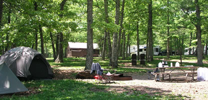
One of the Shenandoah National Park Campgrounds
Camping is available in the Park in addition to rooms at Skyland, Big Meadows Lodge and Lewis Mountain Cabins.
There are five campgrounds in Shenandoah National Park. They all have roomy sites with a picnic table and grill. All are near a section of the Appalachian Trail. All have some accessible sites. All except Mathews Arm have showers, laundry, and a campstore.
No campground has hookups for water, electricity, or sewage, but Mathews Arm, Big Meadows, and Loft Mountain have dump stations. All are accessed from Skyline Drive.
Big Meadows at Milepost 51 (first-come, first-served until May 14, then reservations are needed.
Dundo Group Campground at Mile 83.7 (reservation only for organized groups through 1-800-365-2267).
Lewis Mountain at Mile 57.6 (first-come, first-serve).
Loft Mountain at Mile 79.5 (first-come, first-serve).
Matthews Arm at Mile 22.2 (first-come, first-serve).
There are also several campstores: Big Meadows at Milepost 51, Elkwallow at Mile 24.1, Lewis Mountain at Mile 57.6, and Loft Mountain at Mile 79.5.
Wood fires are only permitted in fireplaces in developed campgrounds and established picnic areas.
Campers must not dig into or level ground.
All firearms, including air pistols, rifles, bows, slingshots, crossbows, fireworks and firecrackers are prohibited.
All motor vehicles and bicycles must remain on paved areas.
Back Country Camping
Most of Shenandoah National Park, including its wilderness, is open to backcountry camping. Special regulations for backcountry camping are intended to keep campers and the park in the best possible condition.
A free permit is required for backcountry camping. Permits are available by mail from Park Headquarters. Write:
Shenandoah National Park
Superintendent, Attn: Backcountry Camping Permit
US Highway 211 East
Luray, VA, 22835
Or call: 540-999-3500, Monday through Friday, 8:00 am – 4:30 pm EST.
Permits are also available in the park at visitor centers, entrance stations, and headquarters. At the park, permits will be issued only between sunrise and one hour before sunset.
Appalachian Trail hikers may self-register for permits on the AT near Rockfish Gap (south) and Chester Gap (north).
Upon selecting an area to camp, look for and try to camp on pre-existing campsites out of sight of trails and roads. Please don’t create new campsites.
Pre-existing Campsites: Campsites have been created and established by prior visitor use and are not posted or signed. You must camp at least 20 yards from a park trail or an unpaved fire road.
Dispersed Camping: If you cannot locate a pre-existing campsite, you may camp on a previously undisturbed area. Please use “pristine site camping” Leave No Trace practices to minimize the impacts of your campsite. Limit your stay to one night and camp well out of sight of trails and roads and other camping groups. Otherwise, “Pre-existing Campsite” regulations apply.
Designated Campsites: Designated Campsites are park-constructed and posted to concentrate backcountry camping at specific high-use sites. Presently, designated campsites are provided only at Appalachian Trail huts to accommodate overflow camping.
Backcountry campfires are not permitted (except at pre-constructed fireplaces at backcountry huts and day-use shelters). You can use a backpacking stove.
Maximum group size is limited to 10 people. Groups larger than 10 people must divide into smaller groups and obtain a separate backcountry camping permit for each group. The separated groups must comply with “camping party” campsite requirements described in the park bulletin.
Food must be stored in one (or more) of the following ways so that wildlife cannot have access to it:
- Hang food in a tree at least 10 feet above the ground and 4 feet out from a tree trunk.
- Hang food at a food storage pole provided at backcountry huts.
- Store food within a park-approved bear-resistant food storage canister. 5. Areas closed to all camping: For distance regulations measured in “yards”, figure that one yard is one of your long strides. For example, to camp at least 10 yards from a stream, take 10 long strides from the streambank and then several more to be sure you are complying with the regulation.
.No Camping may occur:
- Within 10 yards of a stream or other natural water source.
- Within 50 yards of standing building ruins including stone foundations, chimneys, and log walls.
- The parkland has a rich cultural history. Camping in the area of former homesites impacts the preservation of those resources.
- Within 50 yards of another camping party or “no camping” post or sign.
- Within mile of a paved road, park boundary, or park facilities such as a campground, picnic area, visitor center, lodge, wayside or restaurant.
- Within 100 yards from a hut, cabin, or day-use shelter. You may camp in a hut or cabin as described in this bulletin. Camping may occur in park-constructed designated campsites at Appalachian Trail huts.
The following areas are identified on maps and are identified by signs on trails accessing the areas. To preserve special resource conditions and values, special rules apply to:
- Limberlost Trail area (bounded by the Skyline Drive, the Whiteoak Canyon fire road, and the Skyland-Big Meadows horse trail)
- Hawksbill Mountain summit (area over 3,600 feet elevation)
- Whiteoak Canyon (between the Skyland-Big Meadows horse trail and the Cedar Run Link trail)
- Old Rag Mountain summit (area over 2,800 feet elevation)
- Big Meadows (Big Meadow clearing area within view of Skyline Drive)
- Rapidan Camp (no camping within mile of buildings)
Camping is permitted in specific backcountry facilities. The Potomac Appalachian Trail Club (PATC) maintains a system of backcountry huts and cabins in Shenandoah National Park.
Huts are three-sided structures located along the Appalachian Trail and operated by PATC for use by long-term hikers. Backcountry camping permits are required for camping in huts, and all park backcountry camping regulations apply.
Permits are not required for cabins, which are reserved in advance from PATC.7. Camping may not exceed 2 nights in one campsite location or fourteen (14) consecutive nights in the backcountry.
Properly dispose of human waste. Defecation within 20 yards of streams, trails, or roads is prohibited. If designated facilities are provided, use them. Solid human waste must be buried in a hole at least three inches deep.
Carry all trash out of the backcountry and properly dispose of it. “Pack it in; pack it out.” Enhance the backcountry experience for all visitors by keeping it clean. Carelessly discarded food scraps and trash may be harmful to wildlife. Leave glass containers at home.
Pets must be leashed at all times and are not permitted on some trails.
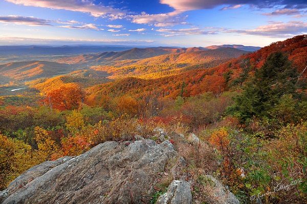
Shenandoah National Park in the Fall
Bicycling
Bicycling is permitted along Skyline Drive and on paved areas in the park, but nowhere else. (The park is preserving the natural world, so no off-road riding of any kind is permitted on trails, fire roads, or grassy open areas.) Because Skyline Drive is a two-lane road with steep hills and many blind curves, park officials do not encourage bicycling, especially for children.
Fishing
A Virginia fishing license is required for those between 16 and 65.
Hiking
There are over 500 miles of hiking trails in Shenandoah National Park. The trails vary in length from short-stretchers to a 101 mile segment of the Appalachian Trail that runs the length of the park.
Many of the trailheads are located on Skyline Drive and in the developed areas. The Whiteoak Canyon Trail leads to six waterfalls and an old-growth forest.
All trails, except self-guided nature trails have blazes, (marks on trees made with paint). The color of the blaze indicates the following:
| White | Appalachian Trail |
| Yellow | Open to hikers and horseback riders |
| Blue | Open to hikers only |
| Unblazed | Nature trails for hikers only |
| Red-Orange | Park boundary |
Watch for Ticks
As you walk through foothill grasses, a tick may hitch a ride. Tick bites are painless, but a small percentage of ticks carry Lyme disease. If you have been hiking in brushy or grassy areas, check yourself thoroughly when you return from your hike.
Use tick repellent to all clothing, including footwear, according to label instructions. Tuck shirts into pants and pants into socks. If you find a tick, remove it with tweezers and seek a ranger’s or doctor’s advice. Wash the area thoroughly with soap and water.
Picnic Areas
There are seven picnic areas. Tables, fireplaces, drinking fountains and restrooms are provided.
| Name | Location |
| Big Meadows | Mile 51 |
| Dickey Ridge | Mile 4.6 |
| Elkwallow | Mile 24.1 |
| Lewis Mountain | Mile 57.5 |
| Loft Mountain | Mile 79.5 |
| Pinnacles | Mile 36.7 |
| South River | Mile 62.8 |
Waterfall Hikes
| Falls | Location | Section of Park | Height (ft) |
| Cedar Run | Mile 45.6 | Central | 34 |
| Dark Hollow Falls | Mile 50.7 | Central | 71 |
| Doyles River No 1 | Mile 81.1 | South | 28 |
| Doyles River No 2 | Mile 81.1 | South | 63 |
| Jones Run | Mile 84.1 | South | 42 |
| Lewis | Mile 51.2 | Central | 81 |
| Overall | Mile 22.2 | North | 93 |
| Rose River | Mile 49.4 | Central | 67 |
| South River | Mile 62.8 | Central | 83 |
| Whiteoak No 1 | Mile 42.6 | Central | 86 |
| Whiteoak No 2 | Mile 42.6 | Central | 62 |
| Whiteoak No 3 | Mile 42.6 | Central | 35 |
| Whiteoak No 4 | Mile 42.6 | Central | 41 |
| Whiteoak No 5 | Mile 42.6 | Central | 49 |
| Whiteoak No 6 | Mile 42.6 | Central | 60 |
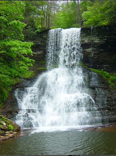
Blacksburg – CascadesFalls on Skylline Drive in Shenendoah National Park. Photo courtesy of Sherry J. Ezhuthachan via Flickr.
Horseback Riding
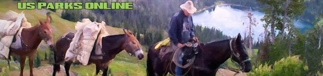
There are more than 150 miles of horse trails in the park. Visitors may bring their own horses, or sign up for a guided trail ride from the Skyland Stables.
Guided horseback rides depart daily (weather permitting) from the Skyland stables (May through October).
Riders must be at least 4 ft 10 in height. Pony rides are available for children.
Pet Information
Pet owners have the responsibility of following park rules for pets.
Pets must be on a leash at all times in the park.
Pets are allowed in campgrounds, but not in lodging units.
Your pet is allowed on most trails, if he/she is on a 6-foot lead. But a few trails are rocky, or designed for family groups; and one trail is ADA accessible. For the protection of the park and the safety of others, a few trails, listed here from north to south, are not open to pets:
- Fox Hollow Nature Trail (mile 4.6)
- Stony Man Nature Trail (mile 41.7)
- Limberlost Trail (milepost 43)
- Old Rag Ridge Trail
- Old Rag Saddle Trail (above Old Rag Shelter)
- Dark Hollow Falls Trail (mile 50.7)
- Story of the Forest Nature Trail (milepost 51)
- Bearfence Mountain Trail (mile 56.4)
- Frazier Discovery Trail (mile 79.5)
- Even though it may appear long, this list totals fewer than 20 miles of the 500 miles of trails in the park!
Visitor Centers
There are visitor centers at three locations in the park. They are Dickey Ridge Visitor Center, Harry F. Byrd, Sr. Visitor Center, and Loft Mountain Information Center.